Institute of Agriculture and Natural Resources
Geitner Simmons, October 12, 2026
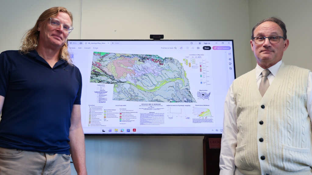
Nebraska teams with USGS to create new statewide surface geologic map
A new academic paper by Paul Hanson and Matthew Joeckel of the Conservation and Survey Division in the University of Nebraska–Lincoln’s School of Natural Resources contains a brief phrase — “new linework” — that looks innocuous but carries enormous meaning.
To create a statewide Nebraska surficial geologic map with new, more accurate lines showing alluvial contours and other dimensions, the two undertook a massive set of meticulous scientific work. In coordination with the U.S. Geological Survey, they reconciled a wide-ranging patchwork of cartographic information to produce the first-ever statewide map showing Nebraska’s surficial geology.
The map, available for the first time at a consistent statewide scale, fills in longstanding cartographic gaps while noting limitations on available evidence in specific cases.
The USGS, which reached out to the university to carry out the project, has posted the mapand its accompanying data online. The Journal of Maps has published the map and an academic paper that explains the project’s methodology and key findings.
With a scale of 1:500,000, the map is “only a starting point” for future refinements, the Husker scientists said, but their achievement provides an important new resource for understanding water management, wildlife habitat, geohazards and construction material availability.
The project underscored the major role played over time by wind-blown effects. The analysis of Nebraska surface conditions found that wind-blown sand, silt and other sediments cover more than 75% of the state.
Reconciling the decades of scattered Nebraska map data involved close, careful analysis of “data taken by different people over different periods of time for different purposes using different scales,” said Hanson, a professor in the School of Natural Resources. Modern tools such as geographic information system software, light detection and ranging remote-sensing technology and satellite imagery provided important help for Hanson and Joeckel in collaboration with the USGS.
One key result: improved “new linework” delineating watersheds in much of the state.
Achieving as much precision as possible about soil and geologic conditions is imperative, Hanson said. Accurate information helps irrigators and water management agencies pinpoint groundwater locations and aids private industry in locating sand and gravel for excavation.
Christopher Swezey, program coordinator of the USGS National Cooperative Geologic Mapping Program, said the mapping project “began with a simple need to fill a gap in geologic maps and ended in a promising partnership between the USGS and the University of Nebraska–Lincoln.”
Nebraska is ahead of most states in incorporating LiDAR data for updating cartographic material, said Hanson, whose professional specialization is studying the Earth’s geologic history, surface processes and deposits over the past 2.6 million years.
The map project underscored, in fact, how the far distant geological past can connect directly to the present, with practical ramifications. To make informed judgments on specific soil types, for example, Hanson and Joeckel, director of the Conservation and Survey Division, sometimes found it important to give thought to which long-ago epoch of geologic time a deposit had occurred — the Miocene (5.3 million year and earlier) or the Pliocene (5.33 million to 2.58 million years ago).
The question may seem academic, but the scientific determination can tell much about soil type, construction aggregate materials and groundwater circumstances.
Scientists “have a respect for geologic time and the geologic processes that shaped our landscapes and formed our soils,” Hanson said. “A lot of the sediments in Nebraska are a gift continually being given by the uplift of the Rockies through time — the sand within the Sandhills, the sediments in the loess hills which were sediments uplifted and sloughed off the Rockies by river systems like the Platte and its precursors.”
Such geological “big players,” he said, also include the present-day Missouri and Platte river systems, whose activity regularly reshapes Nebraska’s physical world.
The new map sets the stage for a variety of long-term follow-up possibilities, Joeckel said. Finer-scale mapping of some parts of the state is one possibility. Others are a new, detailed geomorphic (landform) map; improved prospects for research such as drilling continuous cores in sediment; and a revised bedrock map of Nebraska.
In coming decades, Joeckel said, Nebraska mapping will likely benefit as improvements continue in GIS, digital elevation databases and geophysical surveys such as airborne electromagnetics.
Meanwhile, Hanson will continue his scientific studies, connecting Nebraska’s geologic present to its deep past.
“Some of Nebraska’s exposed ground conditions have been there for millions of years,” he said. “Those time periods are so long that they’re hard to fathom.”