Conservation and Survey Division
Geitner Simmons, September 21, 2023
California turns to Nebraska know-how on aquifer analysis, groundwater management
Record snowfall and rainfall this year, with tropical storm Hilary providing the latest blast, have brought major challenges to California but also an important opportunity for the managed recharge of its groundwater. Californians have begun directing the water to underground aquifers, where it can be most effectively stored for the long term. For guidance in that effort, the nation’s most populous state is turning to Nebraska for its know-how on groundwater management.
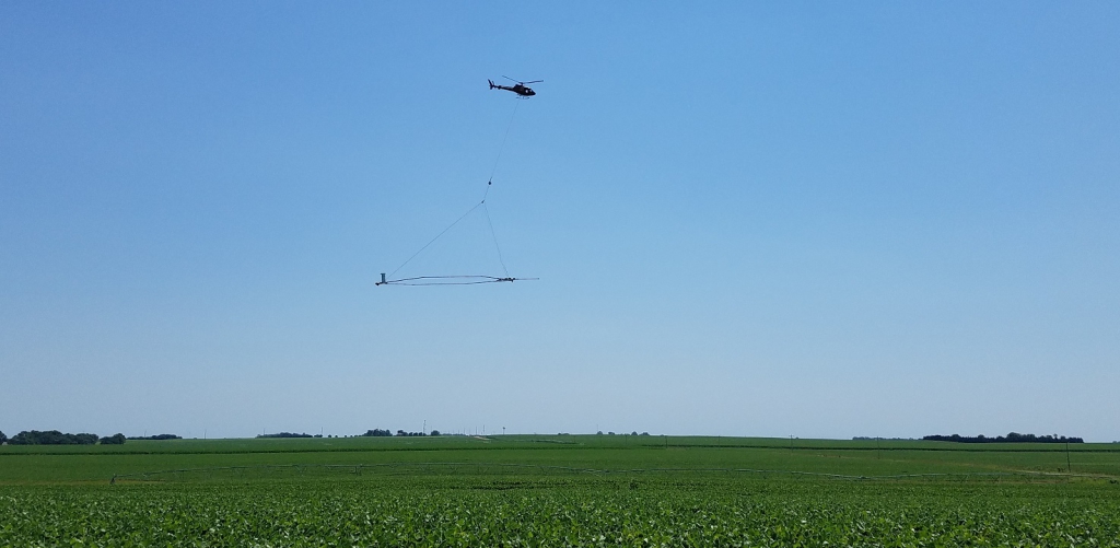
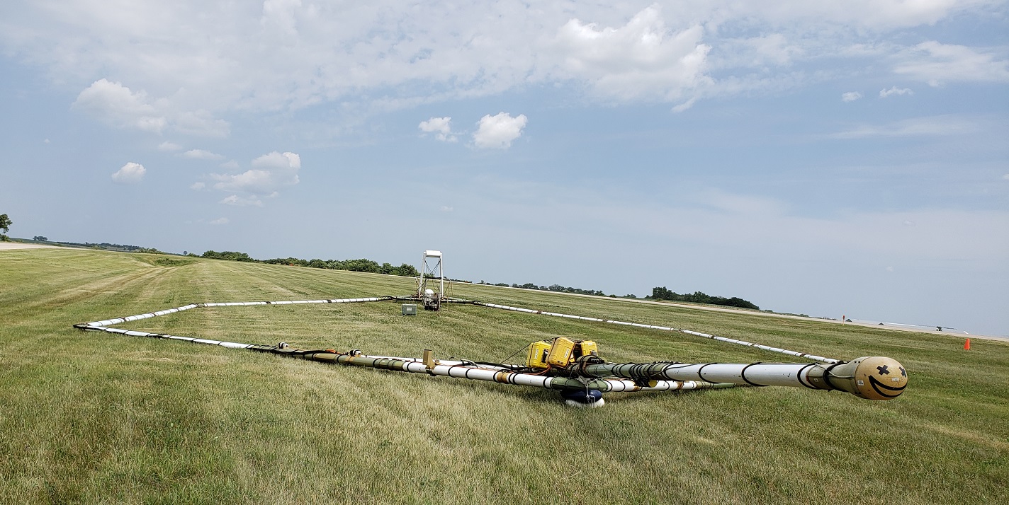
Specifically, the Nebraska example is helping California make the best use of airborne electromagnetics, a technology that senses subsurface conditions and helps identify optimal sites for long-term groundwater storage. In airborne electromagnetics, a helicopter flies over a designated area carrying a large loop of wire whose electromagnetic signaling helps image subsurface conditions and create a 3D geological model.
Starting in 2007, Nebraska pioneered the use of airborne electromagnetics on a regional scale for aquifer mapping through a collaboration called the Eastern Nebraska Water Resources Assessment. Six Nebraska natural resources districts have been key partners in that work from the start, as has the Conservation and Survey Division, the natural resource survey component of the University of Nebraska–Lincoln’s School of Natural Resources. The other partners are the Nebraska Department of Natural Resources and the U.S. Geological Survey.
Jesse Korus, an associate professor in the School of Natural Resources and groundwater geologist in the Conservation and Survey Division, has done extensive scientific work for those aquifer surveys from their beginning. Katie Cameron, a CSD colleague with Korus, is coordinator for the Eastern Nebraska Water Resources Assessment. Cameron has played an instrumental role in coordinating the surveys in the eastern part of the state, Korus said.
“It is no exaggeration to state that Jesse’s work, and that of Katie, have helped UNL earn a global reputation in the application of airborne electromagnetics to groundwater assessment,” said CSD Director Matt Joeckel, the SNR senior associate director and Nebraska state geologist. “Their scientific expertise certainly helps Nebraskans every day. At various points, yet other CSD personnel have made contributions to ENWRA. Some groundbreaking publications have emerged from this work.”
The airborne electromagnetic surveying now extends to regions across the state through partnerships with additional Nebraska natural resources districts.
“(Korus) has gladly shared his expertise with groundwater experts not only in California, but also in Iowa, Missouri, Kansas, Minnesota, Arizona, Texas, Colorado, New Zealand, Denmark, the U.K. and Argentina,” Joeckel said.
In acknowledgement of Nebraska’s depth of experience on this front, the California Department of Water Resources contacted Korus more than two years ago and asked him to serve on that state’s Airborne Electromagnetics Technical Advisory Committee, after California adopted landmark groundwater management legislation. The state approved significant funding for airborne electromagenetic identification of aquifers and for directing water flow via infrastructure such as canals, pipes and ditches.
Groundwater provides 41% of California’s total water supply during average years, and during critical drought years, the figure rises to 58%.
Airborne electromagnetic technology “provides a window into the subsurface, a window that’s not really achievable in any other way,” Korus said. “This window allows us to see and understand what we need to in order to manage our water resources, replenish our groundwater supplies, and do a whole host of other planning and management activities related to groundwater.”
The recent record snowfall and rainfall created major challenges for Californians but also “has provided them an opportunity to replenish their aquifers by capturing runoff and allowing it to infiltrate and fill up some of those depleted basins,” Korus said. “That sounds simple enough, but it’s really not. It’s a very complicated approach from a scientific perspective, and regulatory and practical ones, as well.”
Korus’ main contribution to the California work has involved explaining how best to distribute the geological data among relevant stakeholders. In California, those end users include agricultural producers, municipalities, industry, environment regulators and water authorities.
“It does no good to collect all this data and then not share it with anyone,” Korus said. “In Nebraska, we’ve built the Nebraska GeoCloud, a web-based system that makes airborne electromagnetic data and geological models available on a public platform.”
From what he’s seen, Korus said California so far has done well in using airborne electromagnetics and following up with appropriate recharge strategies. California has benefited from the years of experience that Nebraska and some other states have had with the technology.
As a pioneer in airborne electromagnetic analysis, Nebraska had to develop its system “from the ground up.” Now, Korus is sharing the lessons learned with experts on a global basis.
Conservation and Survey Division Natural Resources School of Natural Resources


